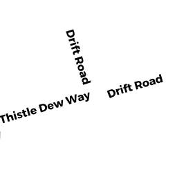
1301 DRIFT ROAD
Owner Information
BONO PAUL A & SUANNE
1301 DRIFT ROAD
WESTPORT, MA 02790


Property Details
1301 DRIFT ROAD is classified as a Single Family Residential (Cape).
The primary structure on this property was built in 1969. There are 2,669ft2 of built area within this property. There is 2,669ft2 of residential/living space within this property.
1301 DRIFT ROAD is valued at $1,055,700. The land is valued at $753,600 and the structures are valued at $253,100. There is an additional valuation of $49,000 on this property.
The most recent deed for 1301 DRIFT ROAD is recorded at the local registrar in Book R131, Page 15. 1301 DRIFT ROAD was last sold on Tuesday, June 26, 2012 for $1.
Assessment data from fiscal year 2022.
Flood Data
According to the FEMA National Flood Hazard Layer, this property does not appear to be in a flood zone. It may also be in an area not yet reviewed. Nonetheless, confirm this information prior to taking any action.
To view the flood hazards around this property, create a FEMA "Firmette" Map of the area around 1301 DRIFT ROAD.
Broadband Internet Providers
| Provider | Type | Bandwidth (mbps) | |
|---|---|---|---|
| Verizon New England Inc. | DSL | 15 | 1 |
| Charter Communications Inc | Cable | 940 | 35 |
| HughesNet | Satellite | 25 | 3 |
| GCI Communication Corp. | Satellite | 0 | 0 |
| T-Mobile | Fixed Wireless | 25 | 3 |
| VSAT Systems, LLC. | Satellite | 2 | 1 |
| Viasat Inc | Satellite | 35 | 3 |
Broadband service provider data from December 2020.
Adjacent Properties
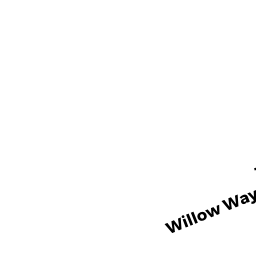
- 0 WILLOW WAY
Vacant, Conservation (Municipal or County) owned by WESTPORT TOWN OF - 1315 DRIFT ROAD
Single Family Residential owned by TOMPKINS SCOTT DOUGLAS & - 1305 DRIFT ROAD
Single Family Residential owned by MEDEIROS JAMES P & DIANE T - 1299 DRIFT ROAD
Single Family Residential owned by MANCHESTER SHEILA A - 1289 DRIFT ROAD
Single Family Residential owned by COLLINS ERIN MARIE - 18 UPLAND TRAIL
Single Family Residential owned by SILVA JOHN P & - 1251 DRIFT ROAD
Single Family Residential owned by SCHNEIDER JOHN D & PATRICIA S - 9 UPLAND TRAIL
Single Family Residential owned by CHAVES TIMOTHY A & JENNIFER E - 0 UPLAND TRAIL
Developable Residential Land owned by KOWAL BRUCE D - 14 UPLAND TRAIL
Single Family Residential owned by WESTGATE CHRISTOPHER JOSEPH - 1325 DRIFT ROAD
Single Family Residential owned by ANDRADE SHARON - 0 ROUTE 88
Vacant, Conservation Organizations (Charitable Org.) owned by WESTPORT LAND CONSERVATION